Prepping for the Porkies

This week, my sister, Alison, and I are preparing to walk about 26 miles of some of the most beautiful and remote wilderness Michigan has to offer. We’re buying food and stuffing packs and gassing up cars.

Our path will take us up and down gentle mountains, along and across two rivers, past seven waterfalls, along the shore of the largest freshwater lake in the world, beneath old growth forests, and past abandoned copper mines. We will sleep the shortest nights of the year (just seven hours from twilight to twilight) to the sound of running water and waves and wind. We will be off the grid the entire time.

We will pay for this privilege with sore muscles and dirty hair.

Such a small price for utter bliss.


A Brief Stop in Pigeon River Country

It’s hard to find a hiking trail in the Lower Peninsula that allows for a 3- or 4-day hike with dispersed backcountry campsites. Jordan River Pathway is advertised as a 2-day hike, but with the new detour around the wetlands, that’s going to be uncomfortable for some. Camping is only allowed at the Pinney Bridge site. So in order to make ours a 3-day, 2-night trip, we drove an hour east to Pigeon River Country and Pickerel Lake, which has a drive-in campsite.

Being Labor Day, the place was packed with RVs and unfortunately our site ended up near some rather loud and boisterous kids who had brought everything they owned with them. But my feet had blisters from our elongated hike out of the Jordan River Valley, so I was happy to be wearing flip flops and carrying things a few yards from the car rather than on my back. We had a nice fire, sitting in the stadium chairs my sister happened to have left in her car, and slept well after our nearly 12-mile day. (My FitBit told me that we had climbed the equivalent of 91 stories during all the up and down and up, up, up.)

The next morning we drove out to the elk viewing area to see if perhaps the elk herd was hanging out there.

They were not.

Nonetheless, it was a pretty field.

And we saw wild turkeys.

Seeing the turkeys was rather macabre because we had already determined that on our way home we were going to stop at Gobblers, a place that sells mostly Thanksgiving dinners for lunch.

The meal was fantastic and we had another hiking trip in the books, albeit a short one. Next year we’ll have to try to get back to the U.P.

Hiking the Jordan River Pathway, Day 2

Day two of hiking the Jordan River Pathway started well. Because we hadn’t been overly ambitious the first day, we were both feeling good the next morning and ready to take on the day.

The weather was nice and cool. The path was rather flat, which is good on the knees and the balls of one’s feet, and on this side of the river there continued to be good scenery and good conversation.

We were even treated to a few overlooks, which we hadn’t really had on the other side of the river.

There was that moment the trail got lost in the overgrown raspberry canes and asters, which were still wet with morning dew, which (the dew) quickly found a new home in the fabric of our pants, which (the pants) became exceedingly cold and heavy until they dried.

But that’s okay. There were signs of fall to admire, like the sumac changing color.

And there were pretty woodland flowers.

And there was more Indian Pipe, this time in a big clump.

We lunched at the riverside, happy to be rid of our packs for a spell and to feel the cool breeze on our sweaty backs. In fact, it soon got so chilly I draped my sweatshirt around my shoulders. It was the last time I would feel cool until we were in the car, blasting the air conditioning.

We did get to walk through my favorite kind of woods — tall deciduous trees with little undergrowth where you can see for some way.

And there was a huge open meadow as well, bouncing with grasshoppers.

Though the afternoon with no shade was rather hot.

We passed and sampled some wild blackberries.

And then things got soggy. We were headed down to the river again and toward some wetlands where there was a nice, flat boardwalk before our final climb out of the valley and into the car.

Or rather there should have been a boardwalk. There used to be a boardwalk. But, as is their wont, rather than fix it when damaged, whoever keeps this trail up thought it would be easier somehow to cut a detour. Which meant more distance and a lot more up and down hills. And, since it was newly cut and not well-trodden, lots of tiny stumps and roots and rocks to trip on at the end of your hike when you are already exhausted.

And so this is the last photo I took. After that, the heavy camera went in the pack and we trudged on. And on. And on. Until what should have been an 8.4 miles hike according to the map became more than 11 miles according to my FitBit.

The last hill was absolutely endless, and we were the only ones taking the trail “backwards” as one person put it, so we continuously passed fresh, clean, bright-eyed people with their intrepid dogs as we slogged our way out of the valley.

There was more to our trip than I’ve shared so far, but that will keep until next time…

Hiking the Jordan River Pathway, Day 1

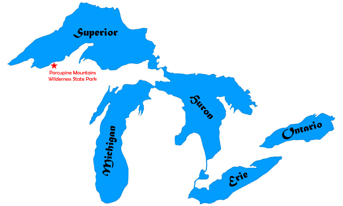
Once again, this year the Annual Sisters’ Hike was in the Lower Peninsula, largely due to time constraints. And since we went on Labor Day Weekend this year and the Mackinac Bridge was closed for six hours on Labor Day as a new safety measure for the Annual Bridge Walk, hiking in the LP meant fewer traffic snarls.

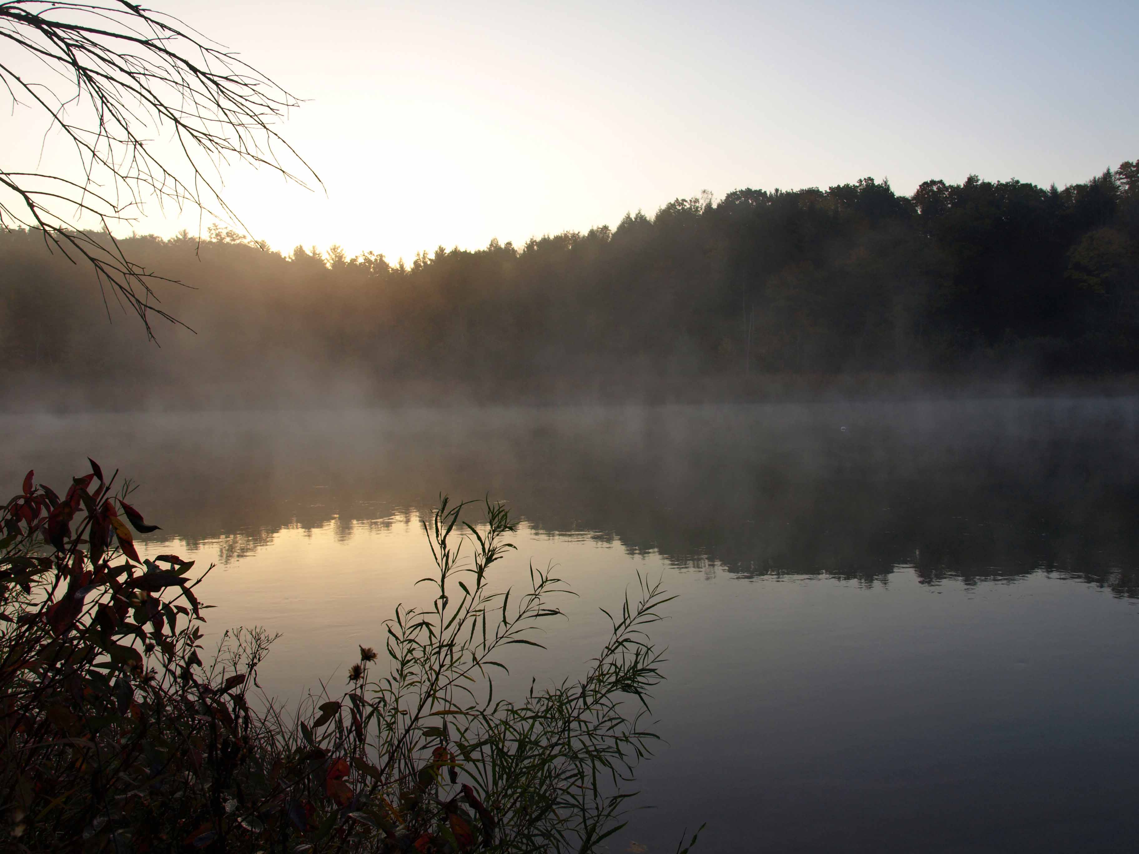
On Friday, September 1st, I got on the road before 7 am, watched a gorgeous sunrise, and reveled in that end-of-summer light.

There was mist in the low places that morning. Blushing trees and burgundy drifts of Joe Pye weed. Fields of beans and corn tinged with the yellow tips of its drying leaves. Rolling hills of sheep, cows, and horses pulling at grass. Sunrise reflected in wetlands dotted with birds. Thin clouds lit up with the color of morning.

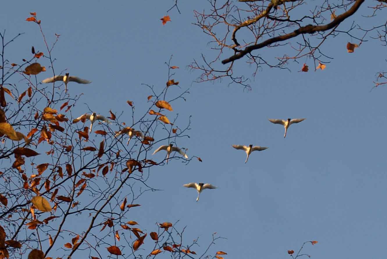
During the drive I saw far more wildlife than I would see hiking, including sandhill cranes, flocks of wheeling blackbirds, and one of the biggest Vs of Canada geese I’ve ever seen. I also had a coyote run across the highway about fifty feet in front of my car. He was large and sleek and completely focused on whatever it was he was chasing on the other side of the road. Totally unconcerned about the car barreling down on him. Thankfully, he timed it right and I had only just had the sense to touch my brakes and then he was gone in the underbrush.

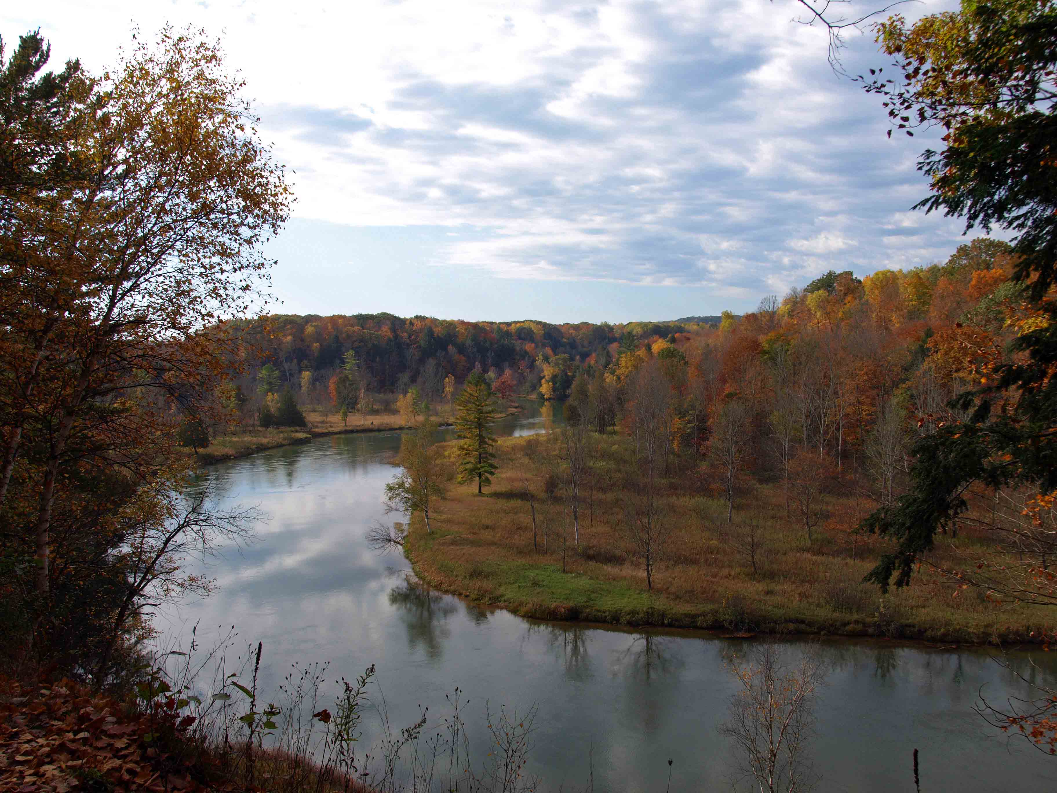
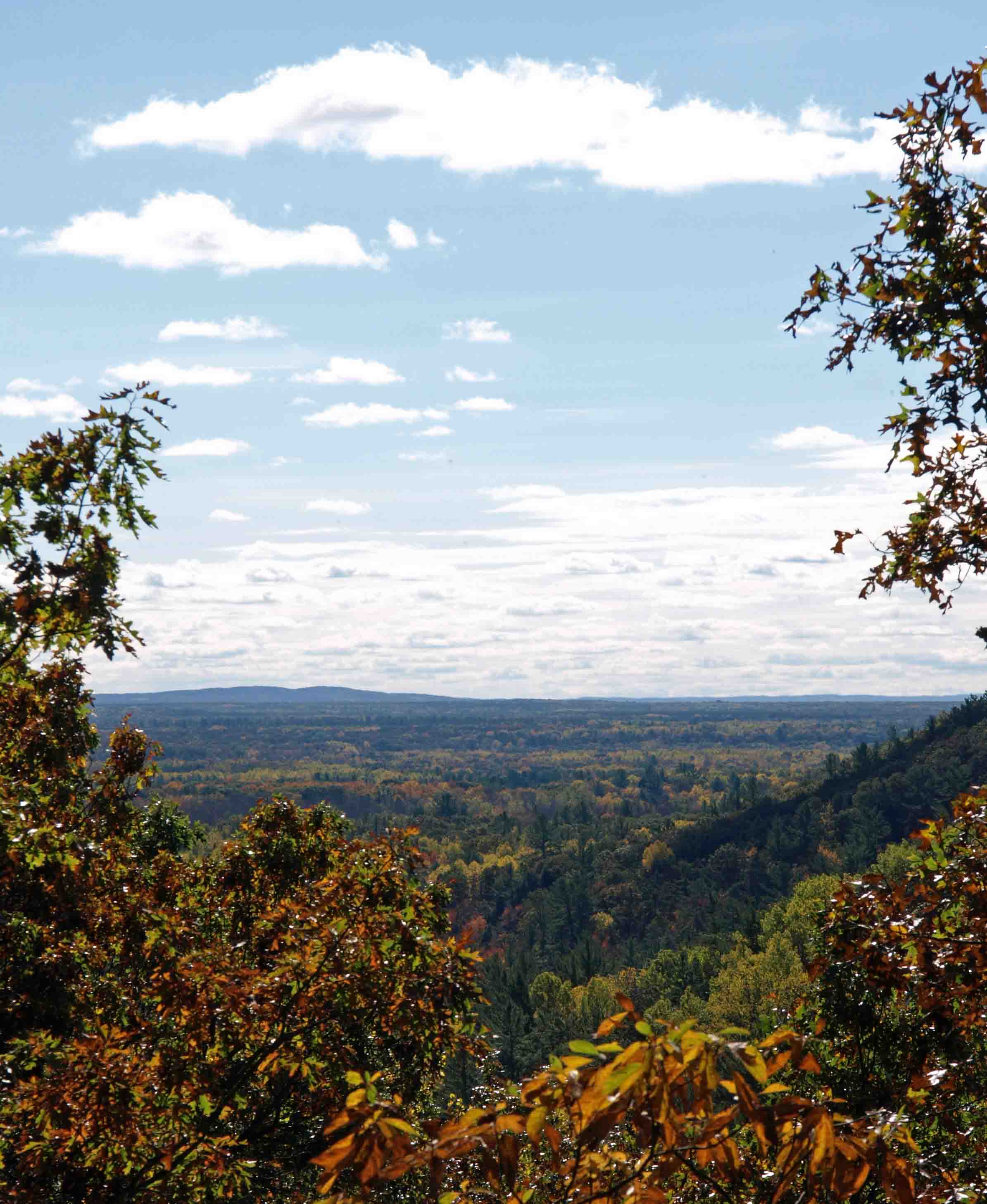
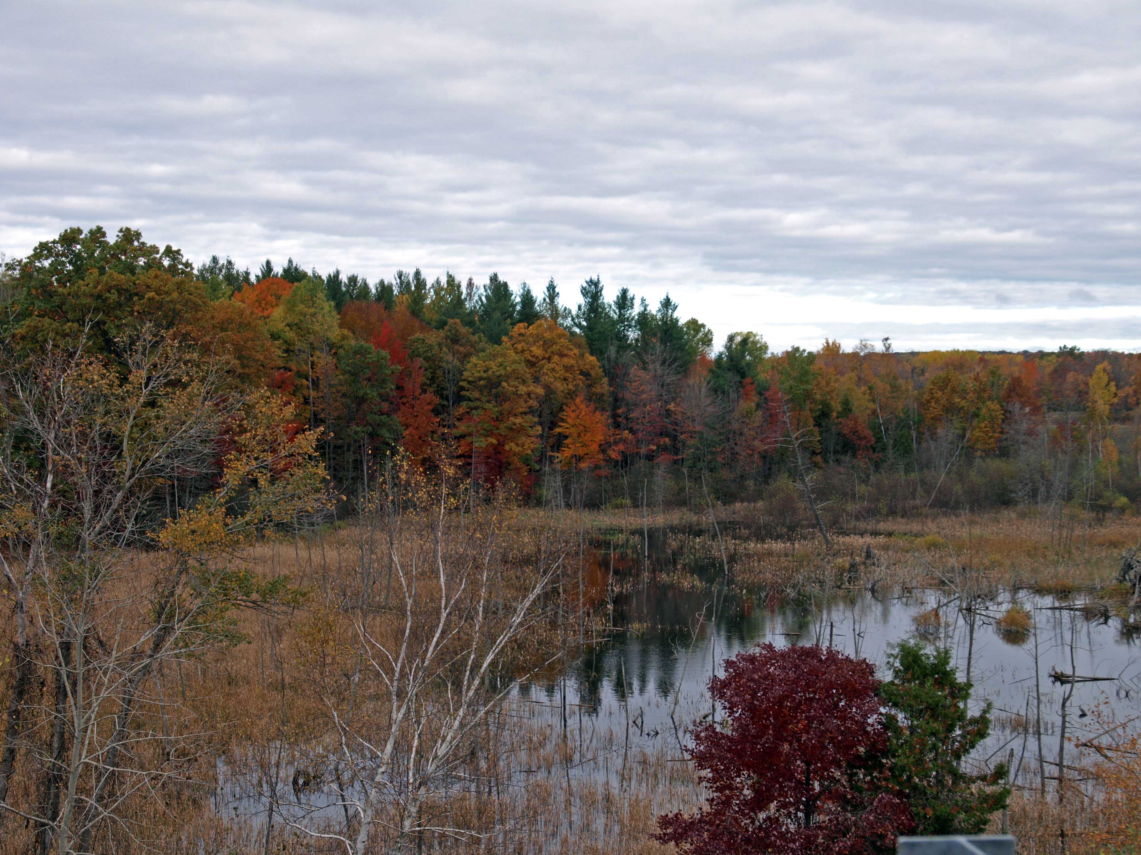
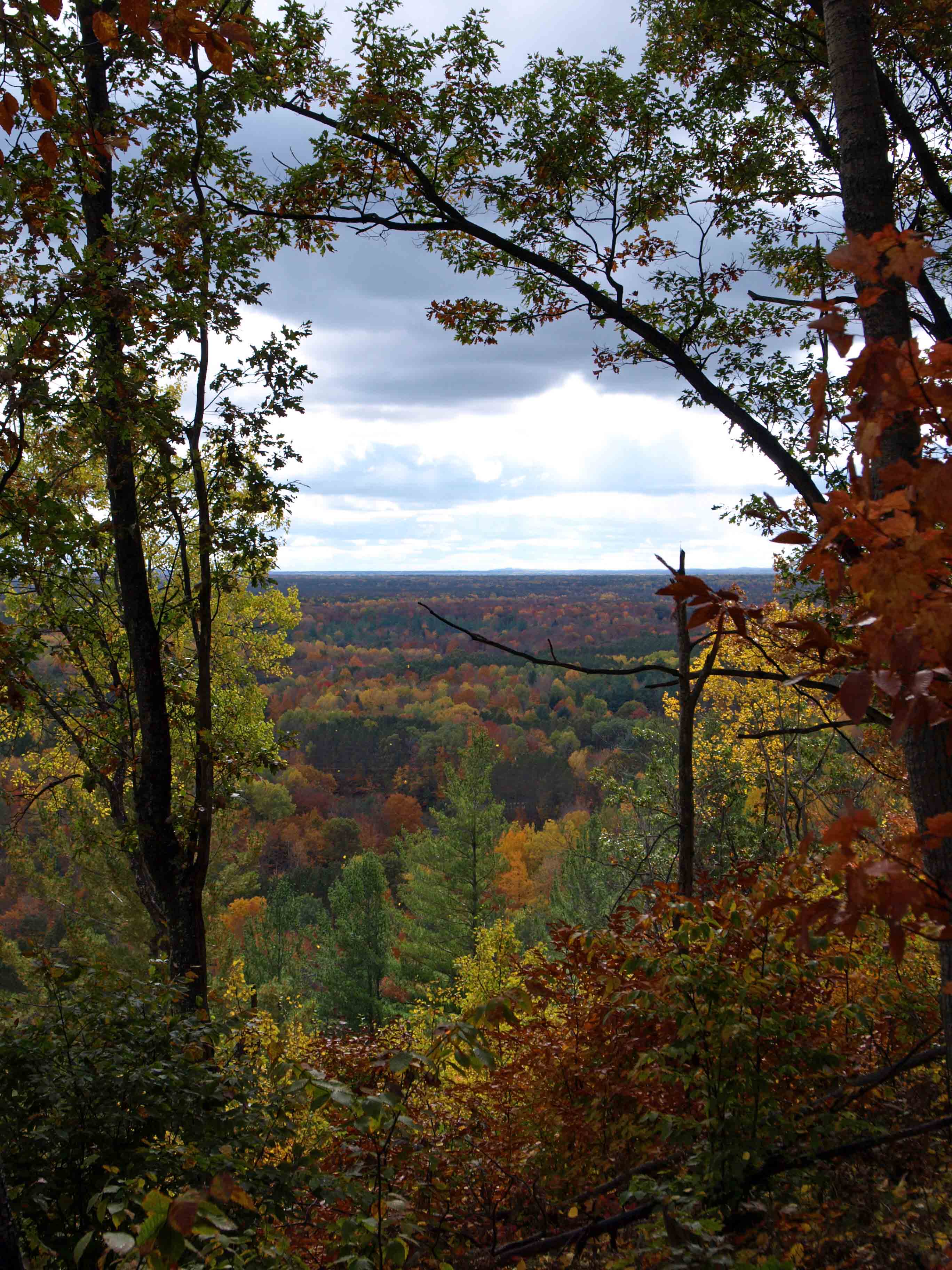
Alison and I met up at the parking area for Deadman’s Hill Overlook (above), left my car there, and drove hers to Landslide Overlook about six miles down the trail. Though we weren’t supposed to park there overnight, I didn’t fancy doing nearly 10 miles of hiking the first day. I wanted an easy 4-5 miles for day one and we figured people probably weren’t ticketed much there. So we left it to chance (and it turned out just fine).

One of the first items of note on our hike of the Jordan Valley was this little white plant, which I’ve only ever seen once or twice.

Indian Pipe is a native wildflower that has no chlorophyll, doesn’t make its own food, and gets its sustenance from decaying plat material through a mutually beneficial relationship with a fungus (so you cannot, repeat cannot grow these in your garden so don’t dig them up). And we saw a ton of them on the slopes near Landslide Creek and Cascade Creek. Interestingly, the flowerhead turns upright after it is pollinated.

We also saw a ton of baby spiders making their perfect little webs all over the place.

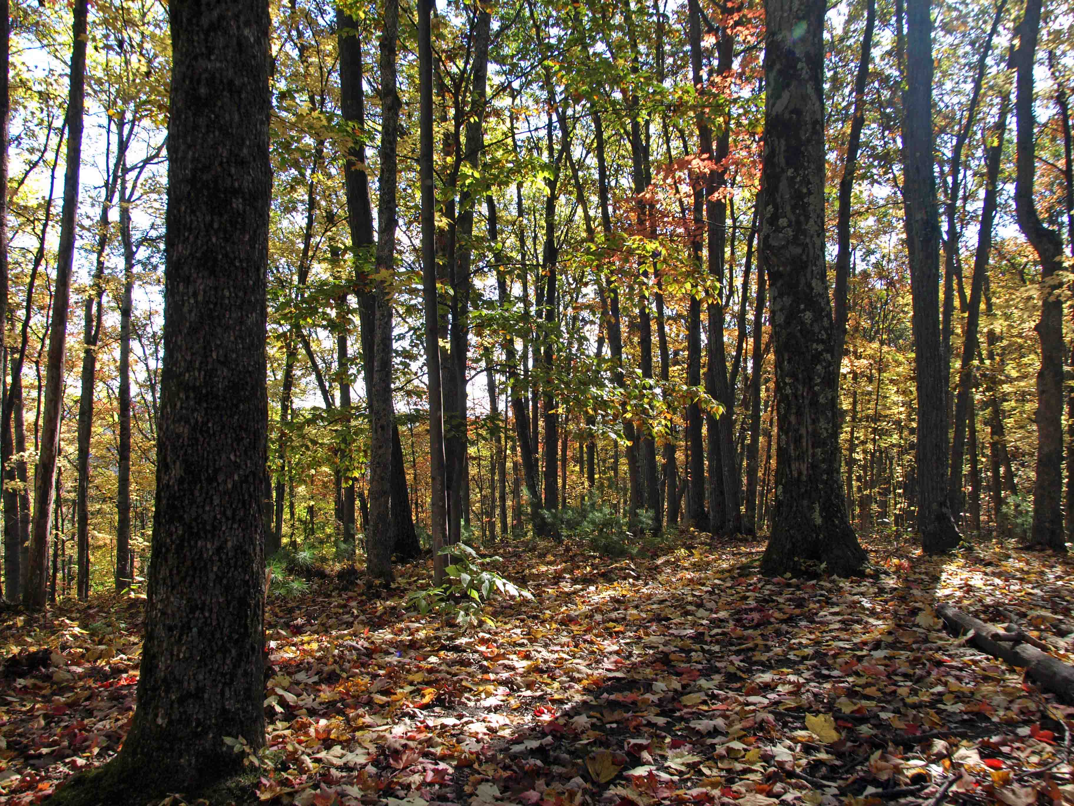
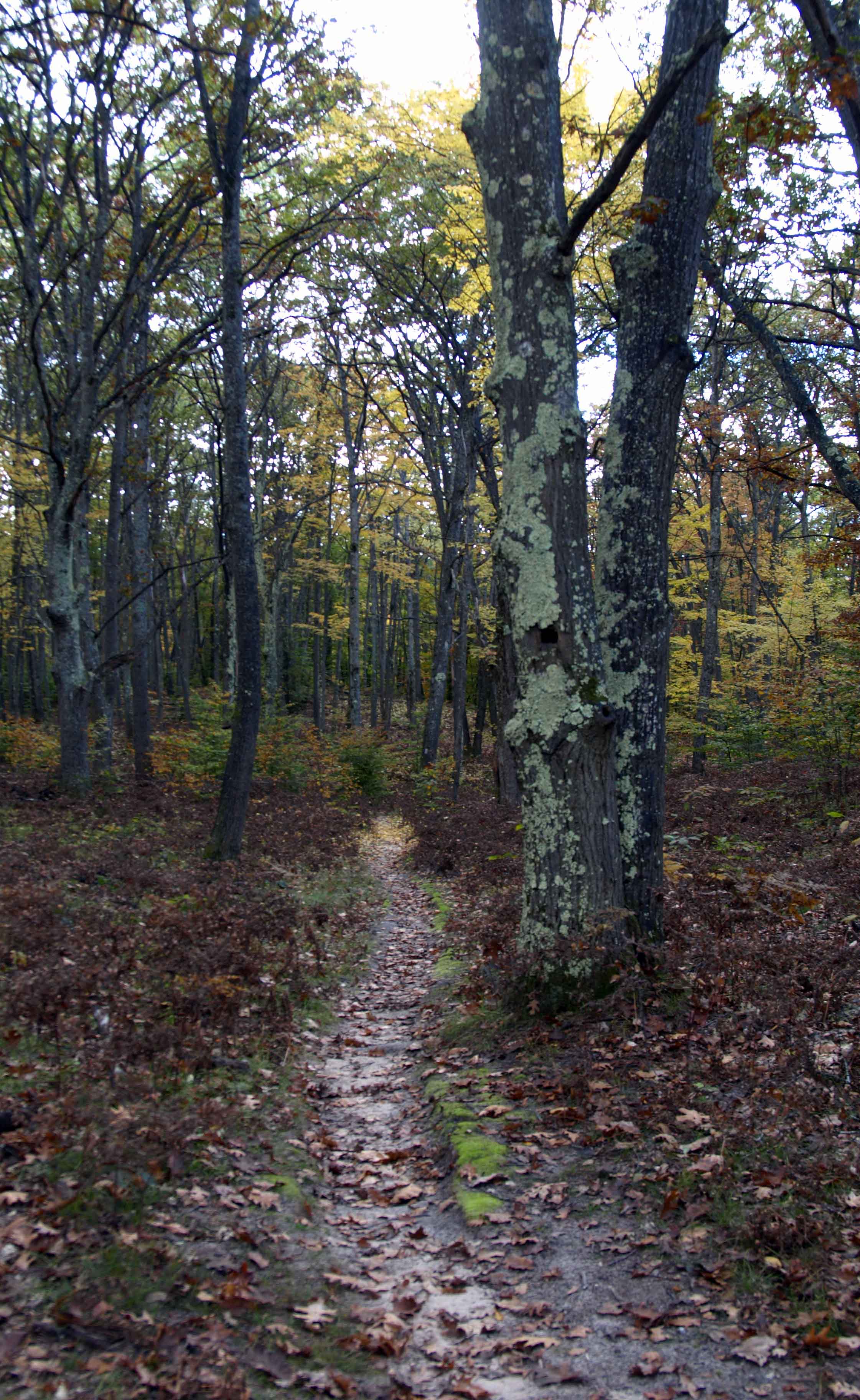
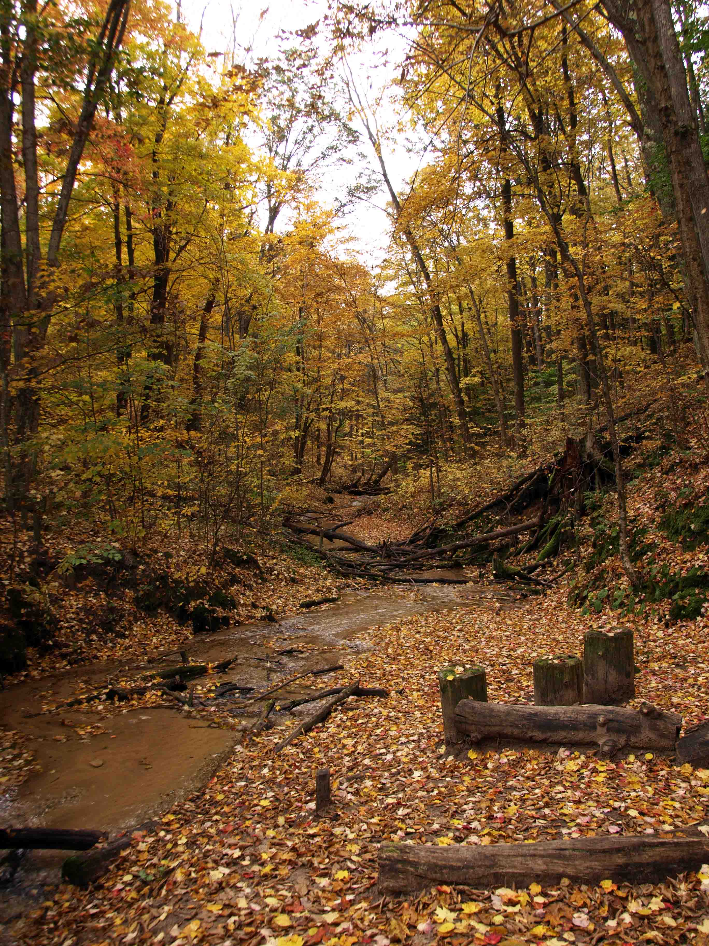
The trail was generally well groomed here, though there was the occasional obstacle to be traversed.

These stairs down toward one of the creeks were in very good shape, though of varying heights, which made for some surprisingly shallow or deep steps along the way.

Alas, it wasn’t long before we ran into our first detour (there would be more…several more).

It seems that in so many state parks there is a tendency to put up a sign rather than repair a failing structure, like those helpful “BUMP” signs you occasionally encounter while driving. Okay…why not fix the road so it doesn’t need a sign?

But I digress…

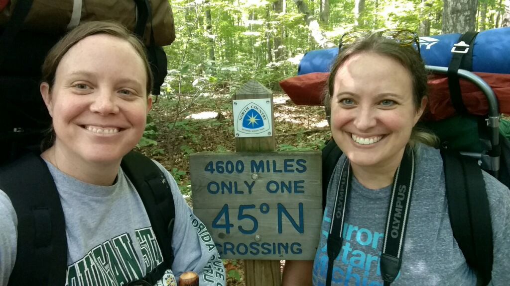
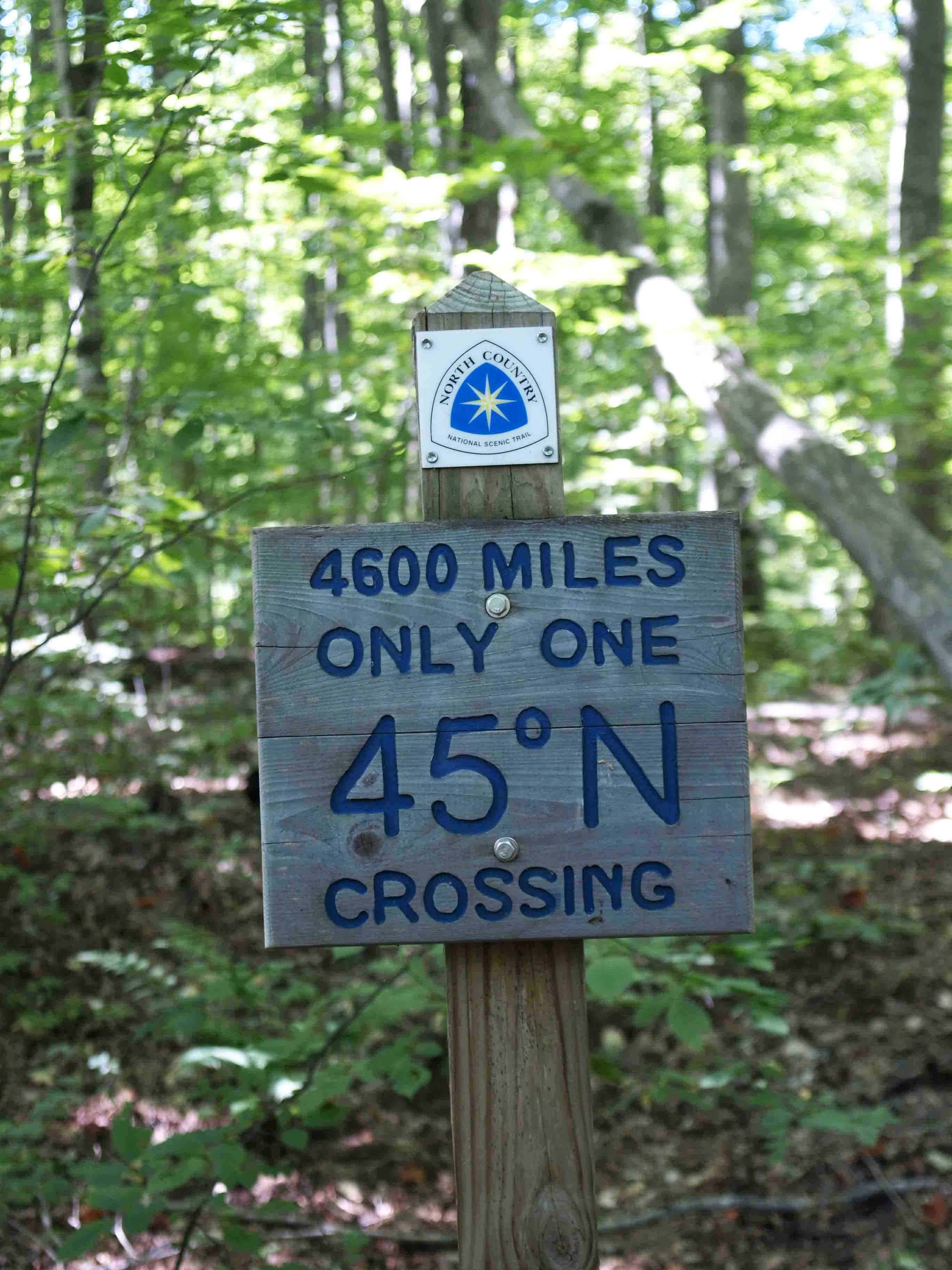
Like many of our other hikes, part of the Jordan River Pathway is also part of the North Country Trail, a network of trails that stretches from New York to North Dakota. The Jordan River Pathway portion is, surprisingly, the only point at which whis trail crosses the 45th Parallel, the halfway point between the equator and the north pole.

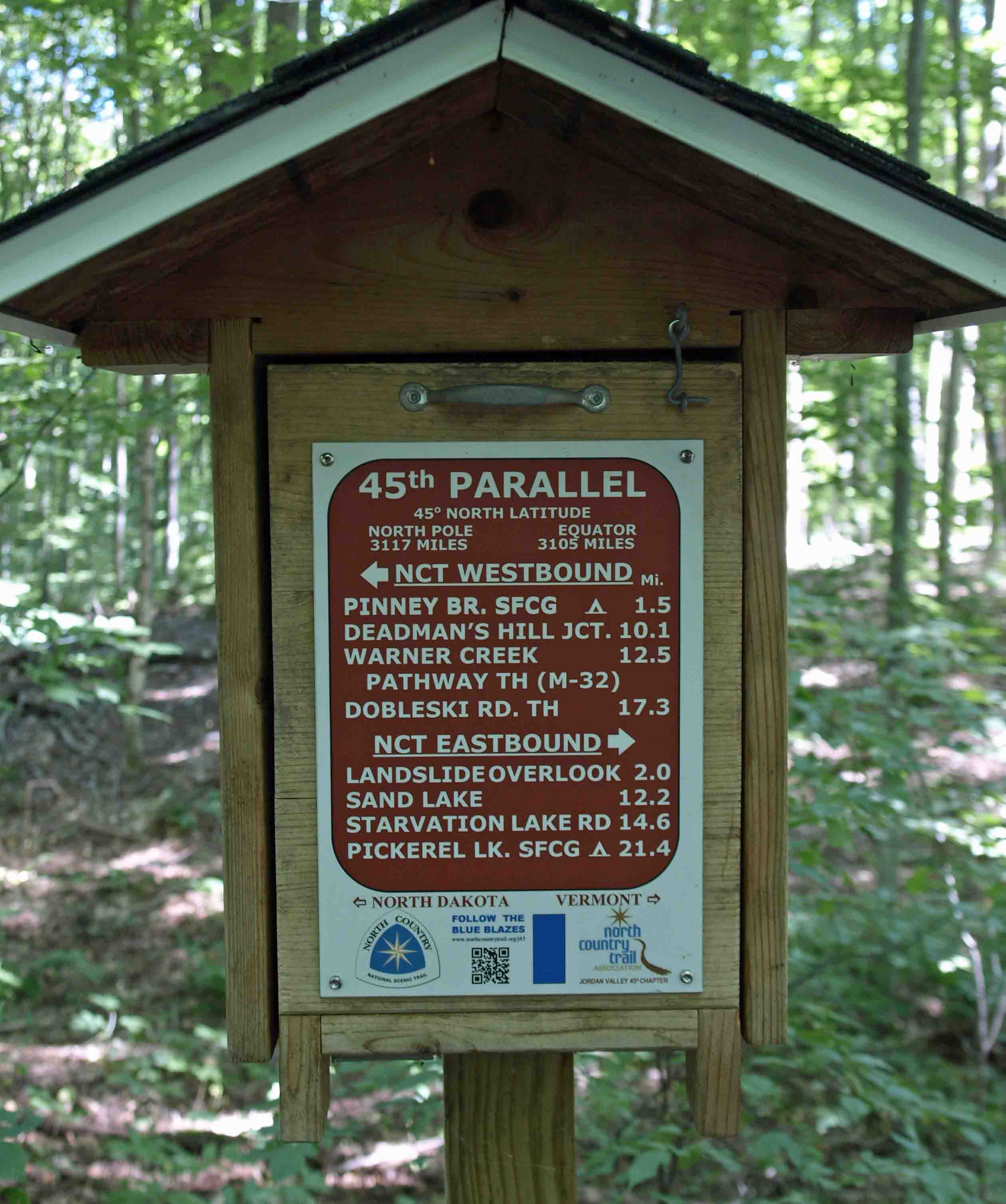
Inside this little sign/house thing is information about the NCT and information about a Facebook page on which you can post your selfies with the sign above. It was obviously created before everyone carried smart phones because it suggests to the hiker that he or she can rest their camera on the part that pulls down and makes a horizontal surface.

Here’s ours.

And because two signs is not marker enough for some people, there of course was a rather substantial cairn a few feet away. It wasn’t interfering with photos or natural water flow, so I let it be.

We stopped for a while at the 45th Parallel to eat lunch. Last year during our trip to the Manistee River, my sister inexplicably brought a can of Spaghetti-Os to eat–cold–because she “saw them in the store and they sounded good” to her. I made fun of her pretty mercilessly and asked her if she needed a stick and a red bandana to carry her things while she hopped a train. So this year she brought them to spite me, which was a strong move.

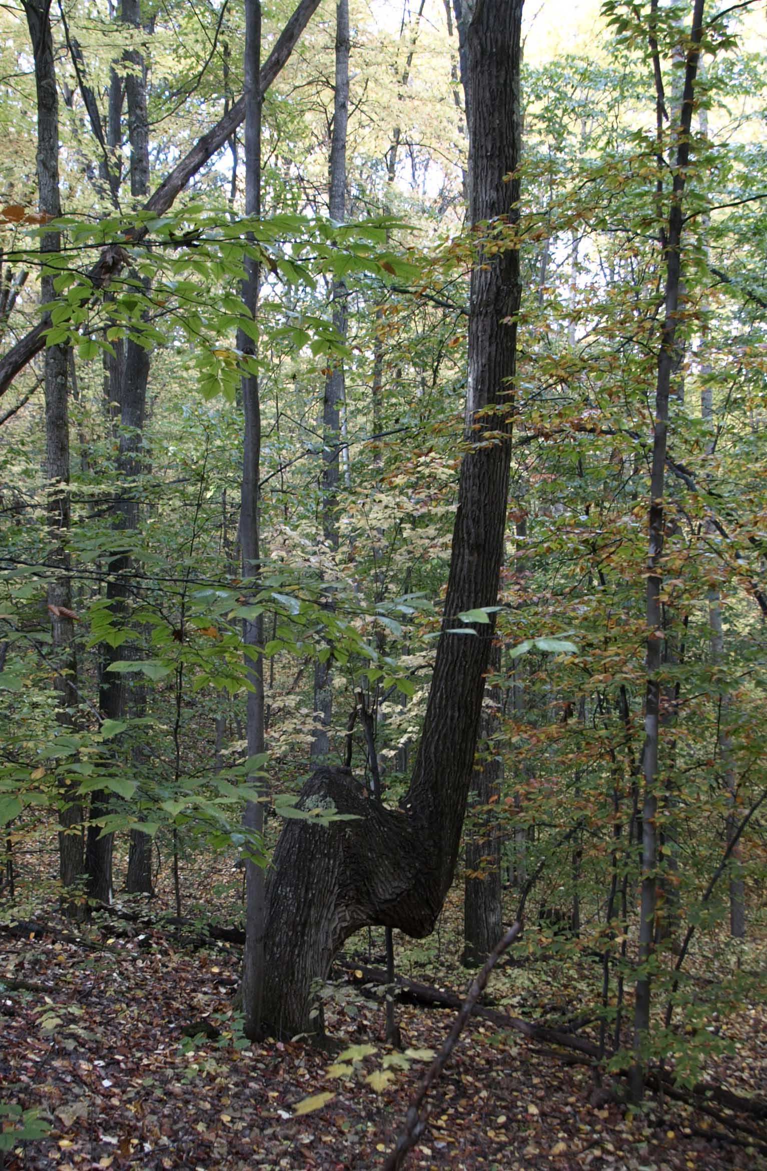
After lunch we encountered this interracial tree couple that had grown together in several spots. I’d never seen anything like that before.

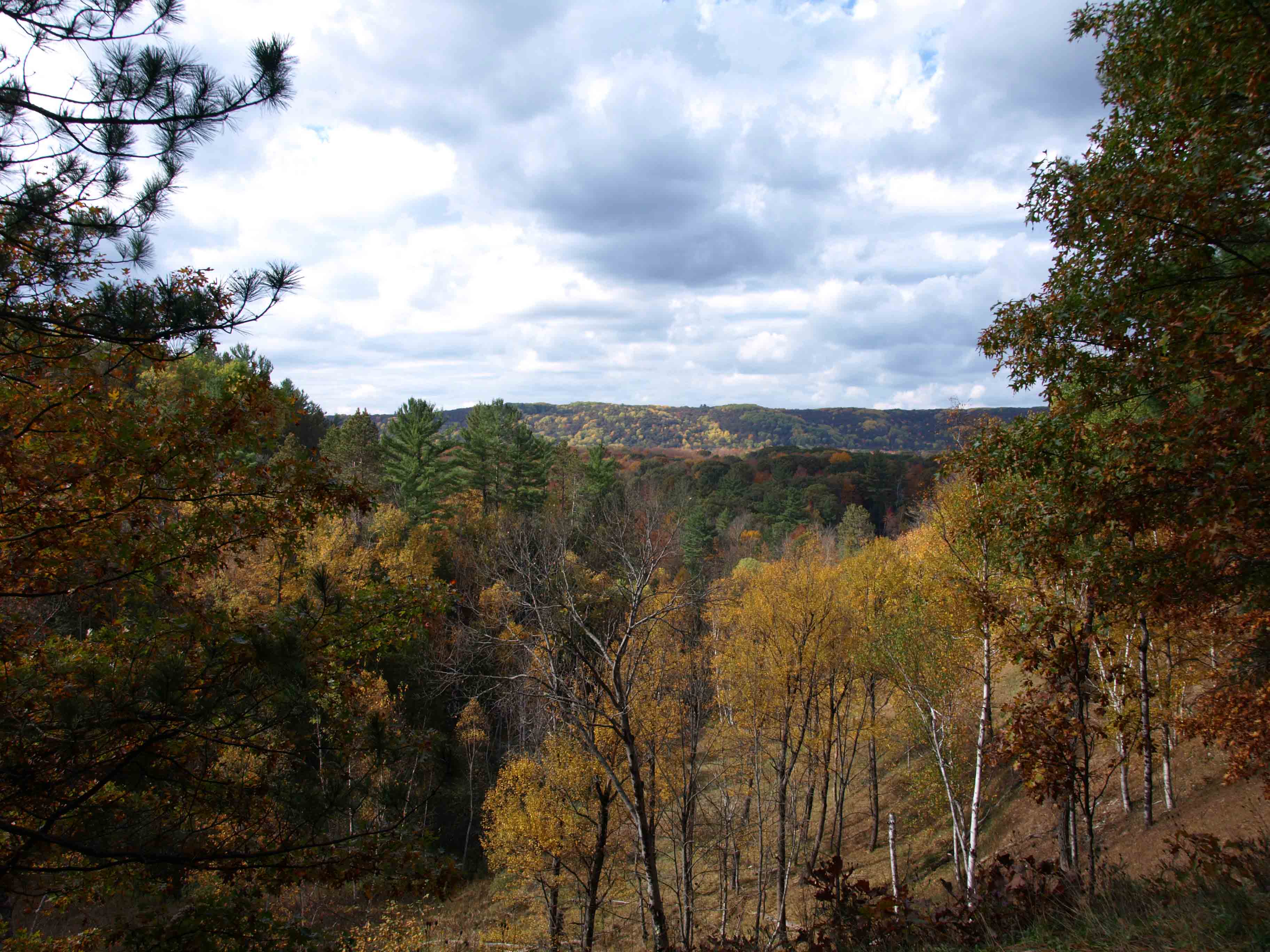
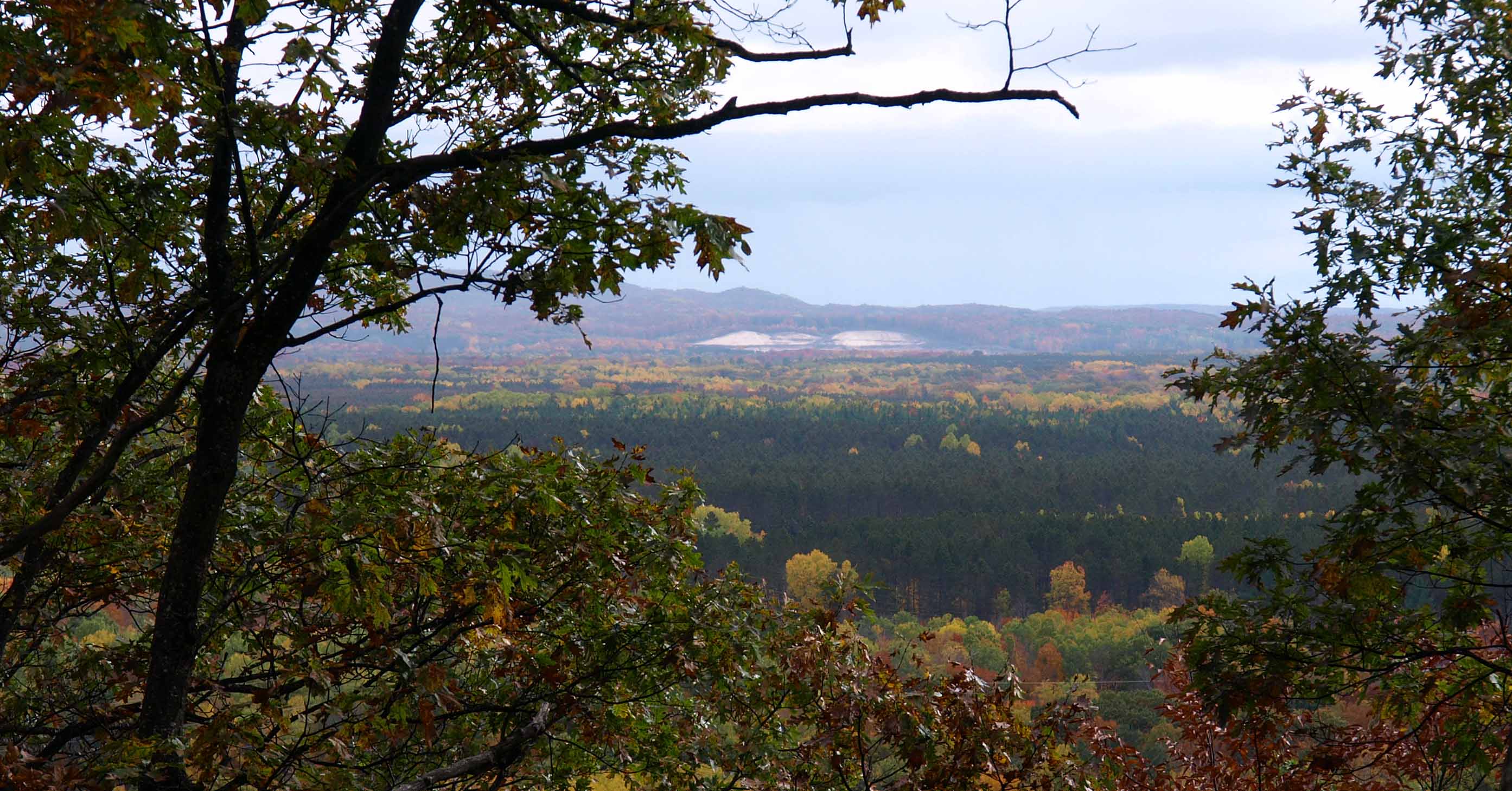
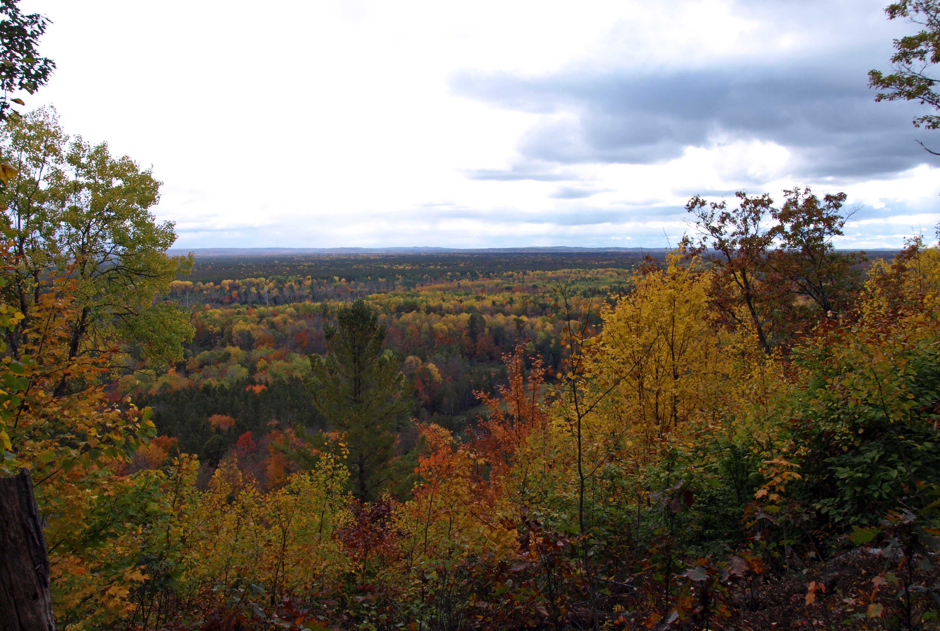
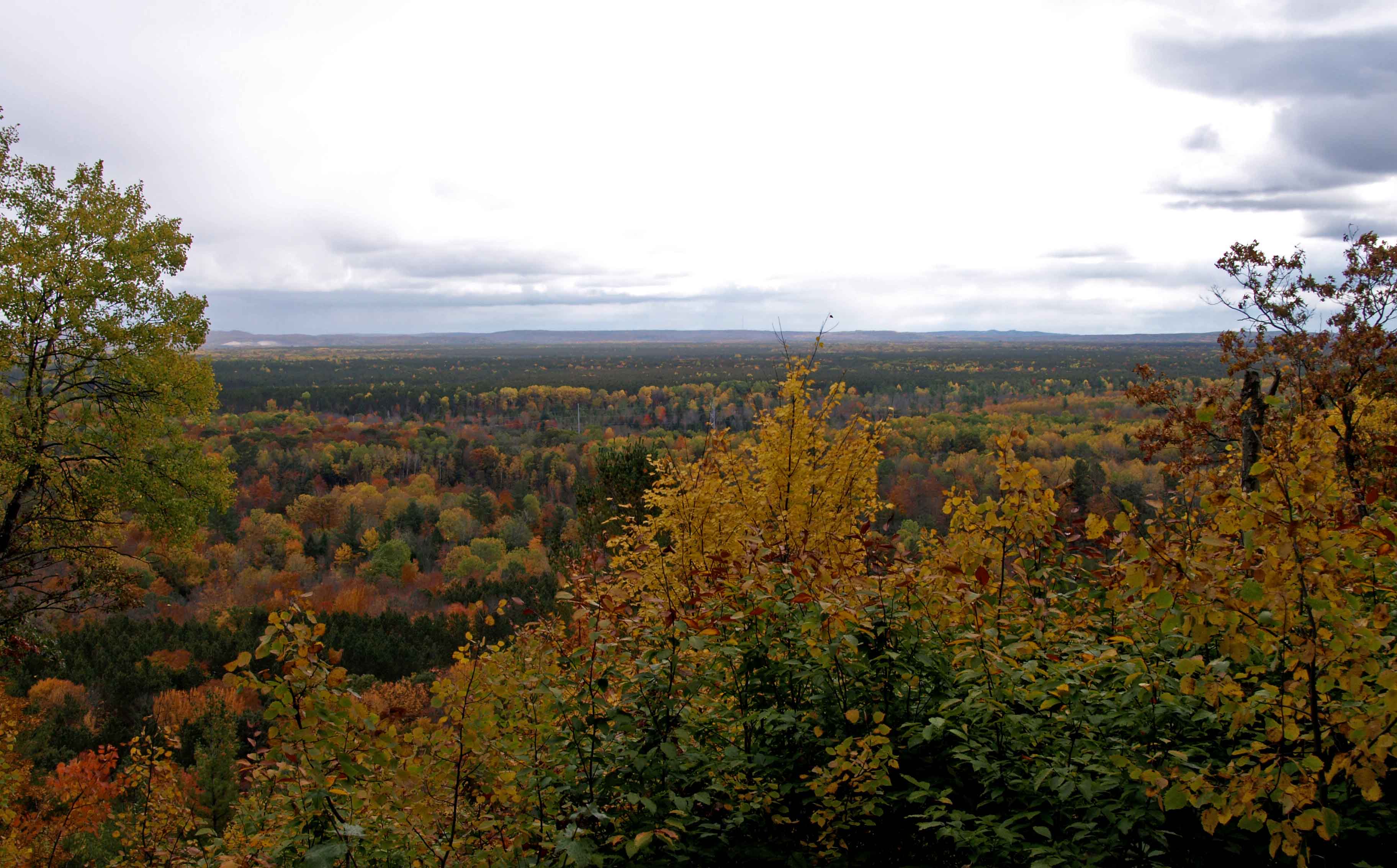
One nice feature of the Jordan River Pathway is the varied landscape. It’s not just all trees and forest. There are a number of open meadows, including this one that was absolutely alive with buzzing bees.

And there are openings in the trees that are largely populated with tall ferns…and the occasional tiny butterfly.

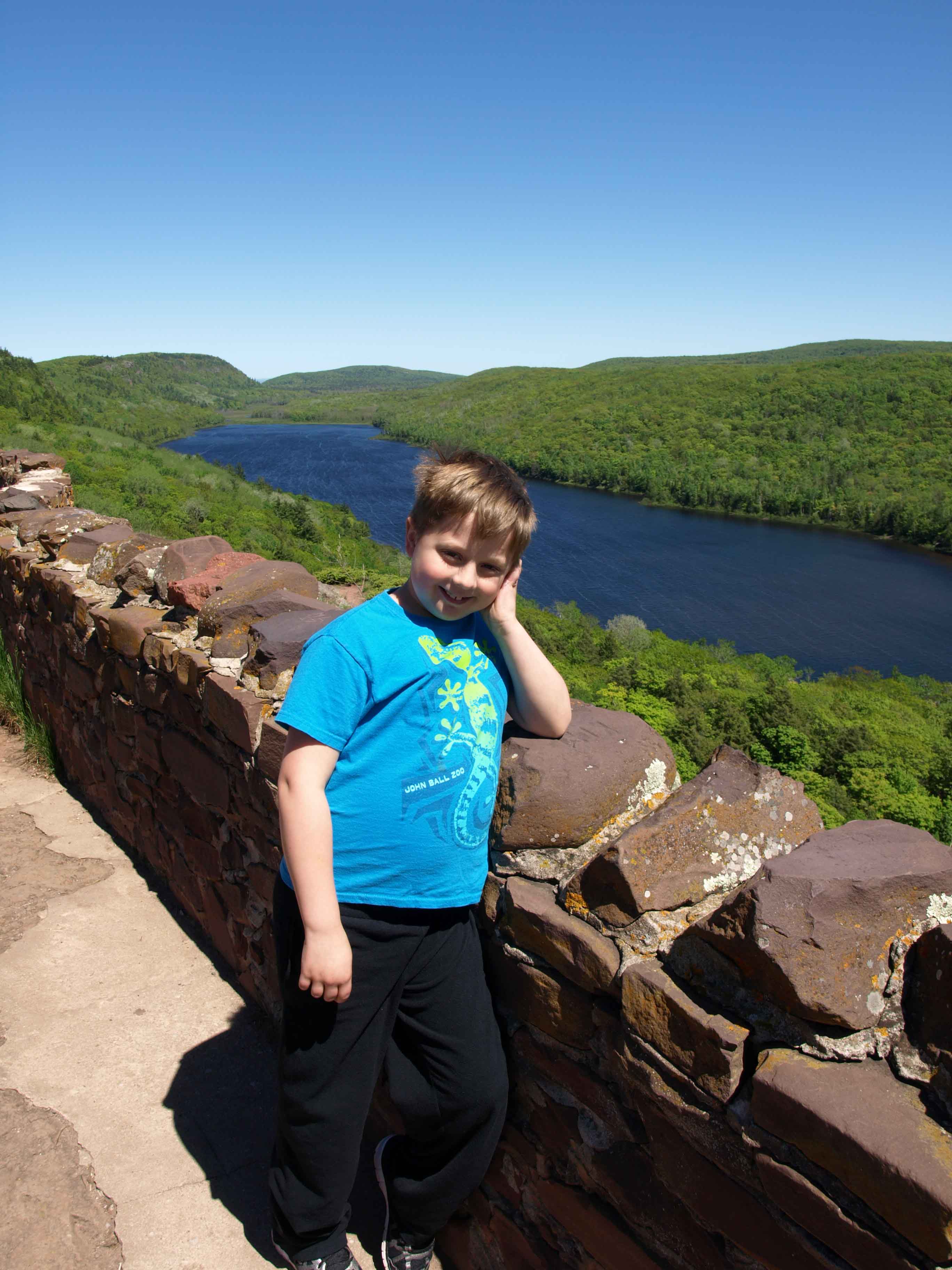
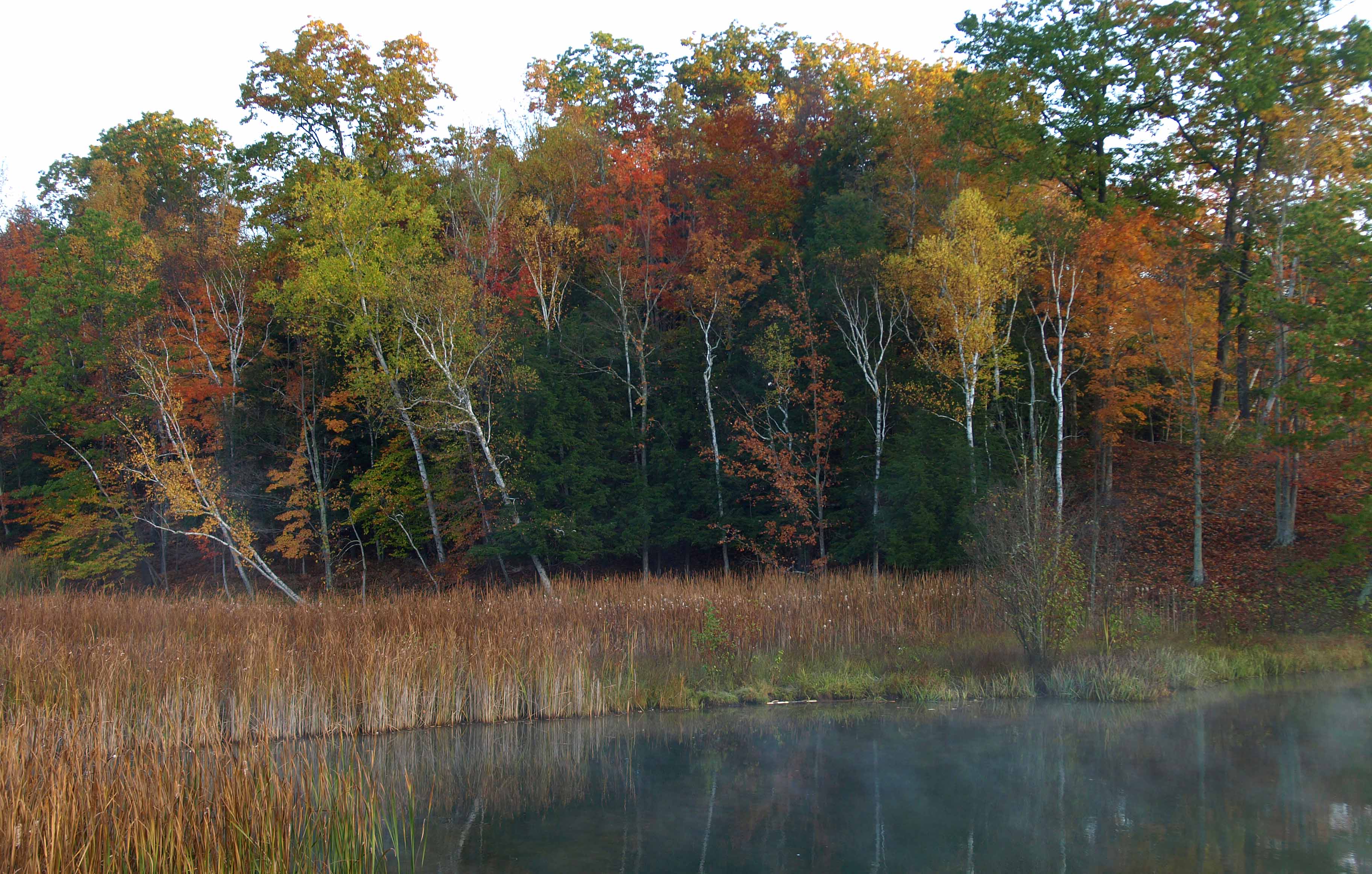
When we got to Pinney Bridge, I was surprised to see how small the Jordan River actually was. I know I’ve done this hike before with my husband, but it’s probably been at least fifteen years, so there wasn’t much I remembered.


After the bridge, it’s a short walk up to the campsite. Along the way we spotted the changing leaves of some wild columbine…

…some touch-me-nots with the exploding seed pods…

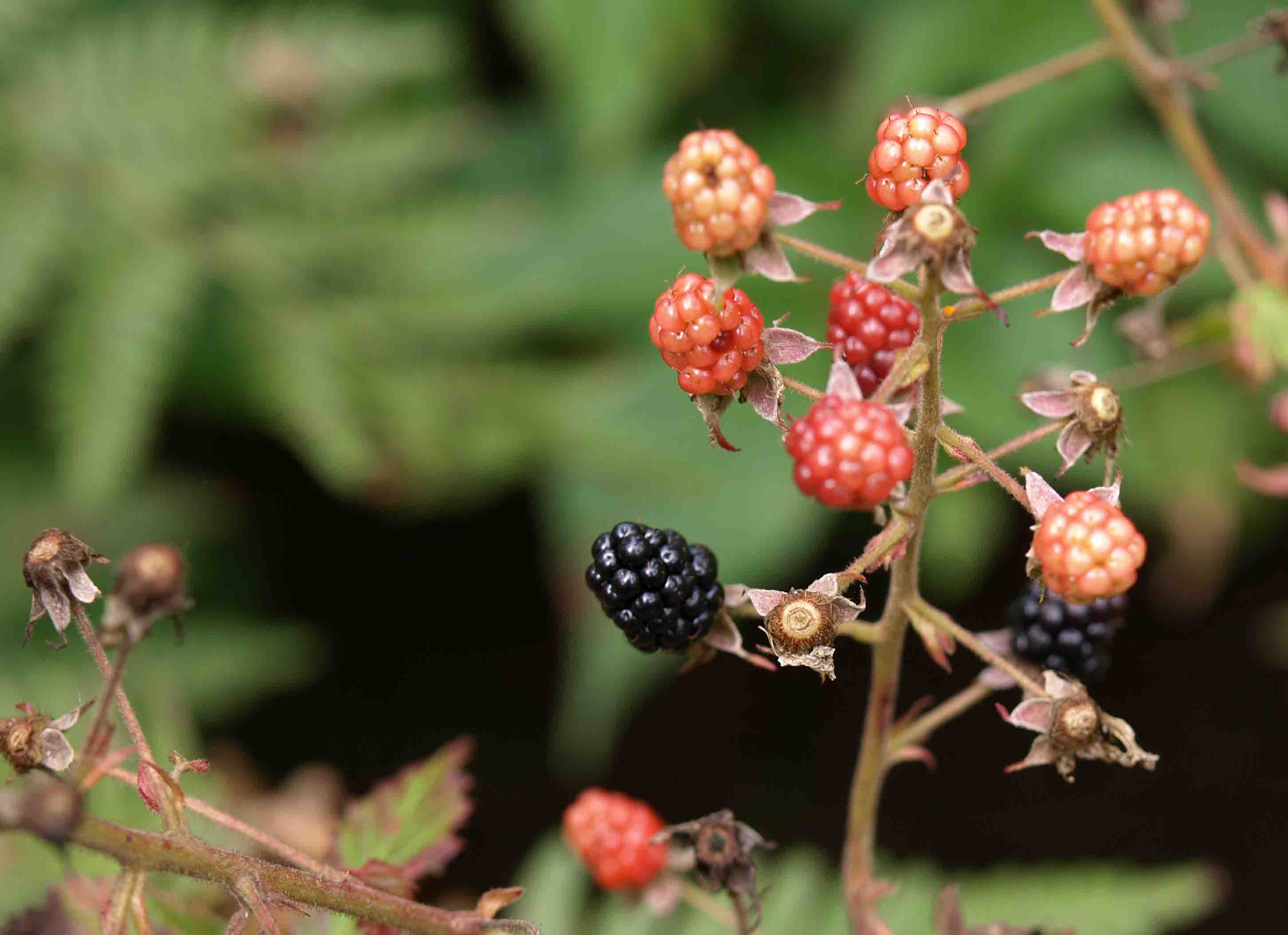
…and lots and lots of wild asters of some variety.

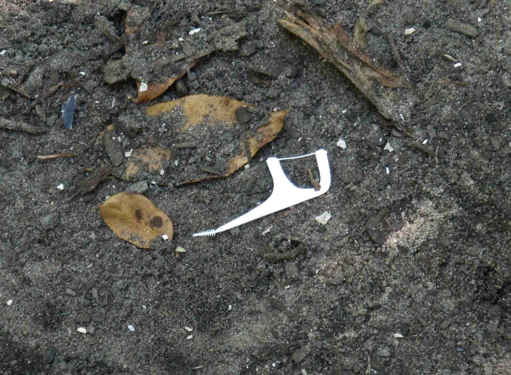
Now, earlier on during our hike, we came across a young, spry couple who told us that the night before they had stayed in site 3 at the campground and that it was a nice one and they’d left some unburned firewood there. So we decided that’s where we would stay. One of the first things I saw was one of these:

I don’t know why, but these little flossing tools seem to seek me out. They are in every parking lot, along every sidewalk. And now, at our campsite. I’ve considered starting a Tumblr that is nothing but photos of these things because I encounter them so often. And they always leave me with the same unanswered questions.

1.) Why do people feel the need to floss their teeth on the run?

2.) Why isn’t regular floss, which is just waxed string that will biodegrade, unlike this molded plastic, not good enough for them?

3.) Why is it acceptable in their minds to throw these things on the ground?

I would imagine this one was just an oversight. Surely hiking people wouldn’t litter on purpose, so hey, I’ll cut them a break. They did tell us about the firewood situation after all. What they did not tell us, because I’m sure they were not aware, was that they had left a live fire behind.


This was what I saw upon arriving, probably six hours after they had left in the morning. Again, an oversight. But a potentially dangerous one. Luckily, the northern Lower Peninsula has gotten far more rain this summer than the area where I live in the southern half, where an unattended fire could have some serious consequences.

Pro tip: Covering a fire with the ashes does not necessarily put the fire out. In fact, in Ye Olde Days, people who heated their homes or cooked with wood or coal fires would “bank them” at night, piling up the ashes, so that they wouldn’t go out and would be easier to start again the next morning. The way to get your fire to go out is to spread the embers as far from one another as you can, not pile them together. And if you’re in a forest you have a responsibility to get that fire out before you leave your campsite. Use water if necessary.

Anyway…

The Pinney Bridge campsite is quite nice. It’s a collection of 15 scattered sites arranged around a common green, a water pump (no filtering!), and two pit toilets, a.k.a. “The Gateway to Hell.”

Alison made one attempt but came back out almost immediately saying, “It’s like a horror film in there.”

“In what way?” I inquired.

All she said was, “Flies.”

This may be too much information, but my sister and I always prefer using the facilities in the woods when we go hiking for precisely this sort of reason. But enough about that. On to the flowers!

This big Queen Anne’s Lace flowerhead was going to seed, while the ones below were perfectly catching the evening light.

It certainly was no horror film most places you looked. More like the setting of a fairytale.

September is truly a lovely time of year and evening is a lovely time of day. One of the reasons I didn’t want to hike 10 miles the first day. I wanted to be able to enjoy the time with the packs off our backs for a while.

We pitched the tent, gathered more firewood, had dinner, read books, took pictures, and chatted about life as the sun sank lower in the sky.

It was a beautiful, marvelous, magical evening…

Camping in the Porcupine Mountains

Ack! Where has summer gone? And how am I still blogging through photos I took during the very first week of summer vacation?!

It doesn’t seem possible that school has started and temps have dropped to a pleasant 70 degrees and trees are already showing signs of autumn, but there it is. A busy summer of travel and writing pushes out time for photo editing and blogging.

One nice side effect (for me and only me) of taking this long to get through my U.P. photos is that I’m slowly remembering and reliving the trip, which I assume can only aid my long-term memory of it. 🙂

But you, poor reader, have been deprived, left hanging and wondering, “Well, then what?”

Finally, I give you the answer. The Porkies.

The Porcupine Mountains are not impressively high for someone with a view of the Rockies, but for a Michigander who has lived most of her life in the flat, farmland-heavy lower half of the Lower Peninsula (and her son who has lived all of his life there) the Porkies were a treat.

You’ll find them way over on the western end of the Upper Peninsula, the furthest west we got on our trip.

Go much further and you’re in Wisconsin. Much further than that and you’re in Minnesota. In fact, on a clear day like the one we had, you can actually see both Wisconsin and Minnesota from the observation tower at the top of Summit Peak — which was, for some time, thought to be the highest point in the state of Michigan. It is not. Unless you count the 40-foot tower they built on top of it.

Our first stop was the ranger station to check in to our campsite. Then a second ranger station to check our firewood. And then to the Lake of the Clouds.

This large lake fed by the Carp River is 1,076 feet above sea level and, eventually, the water here makes its way down into Lake Superior, the largest body of fresh water on earth. Around the same time we were visiting the Lake of the Clouds, my husband was visiting the Dead Sea 1,412 feet below sea level, which is one of the saltiest bodies of water on earth, and which does not feed into anything.

The boy reveled in leaping around the large rock outcropping.

Though I did get him to stand still for a moment to take a selfie with me.

It was très windy up there, but warm in the sun. I think both of us could have stayed up there most of the rest of the day.

Here’s a shot of the Carp River winding away (or toward, I don’t know) the lake.

I simply MUST get back up here some autumn for the fall color.

We ventured down the trail a little way to get another angle before heading to Summit Peak. Here’s where we had just been standing.

Believe me when I say that this is truly impressive for Midwestern Standards. 🙂

The Porcupine Mountains are part of a very old mountain range (some say 2 billion years old…but I don’t know enough about that to comment) formed in part by midcontinental rift and volcanic activity, and later by the action of glaciers during various ice ages (more about the geology of the range here). With around 90 miles of hiking trails and covering an area of more than 47,000 acres, it is, according to the DNR, “one of the largest relatively undisturbed northern hemlock-hardwood forests west of the Adirondacks.”

What’s nice about the Porkies is that you can visit nearly all of the big attractions by car and short hikes. Which is good when you have a nine-year-old boy in tow.

And since it takes so long to drive there, you’re more than ready to get out and do a bit of walking and climbing of steps once you get there!

This is atop the tower on Summit Peak (1,958 feet + 40 for the tower). That’s nothing compared to Mount Mitchell in North Carolina at 6,684 feet (the highest point in the Appalachians) and falls even further behind when you consider Mount Elbert in Colorado at 14,440 feet (the highest point in the Rockies) or Aconcagua in Argentina at 22,837 feet (the highest mountain in the western hemisphere). But hey, it’s what we’ve got.

And the boy and I thought it was beautiful. From up there we could see Lake Superior, the Apostle Islands of Wisconsin, and a thin line in the far distance that I have to believe may have been Minnesota. At least, that makes sense thinking of the map.

Eventually, we came down from the mountain and drove to our campsite on the far western end of the park at Presque Isle State Campground near the Presque Isle River. We set up the tent, brought out the hot dogs and s’mores ingredients we’d been keeping cool in the cooler for days, and built a fire.

This became the boy’s favorite part of the trip, bumping the Pictured Rocks Cruise out of the top spot.

It was going to be in the 40s that night (around 7 degrees Celsius for my international readers) so I let the boy use my new sleeping bag, which is rated for 5 degrees Fahrenheit. I used one of the old sleeping bags and added a heavy quilt, something you can’t do when backpacking!

We finished reading our book (we’d been reading Prince Caspian in the Chronicles of Narnia series every night — we’re currently on The Last Battle) and then broke out some of the Michigan-specific picture books I’d brought along, including Mackinac Bridge by Gloria Whelan and The Legend of Michigan by Trinka Hakes Noble, both of which are fantastic and both of which had been given to the boy by friends of ours when he was very small.

And we watched the sun sink into Lake Superior just a dozen or so yards from our tent.

The next morning I checked my phone for the time and groaned to see that we were both up at 5:30 am. But hey, an early start when you have 5 to 6 hours of driving is good, right? We had a quick breakfast of granola bars and fruit and packed up the car. When we were driving away from the campsite, the clock in my car and the clock on my phone were an hour off of one another. It was only then it hit me that we were in a different time zone!

Image result for time zone map michigan

Turns out, the counties bordering Wisconsin are on Central Time. In fact, I was so far west that if I went far enough south from that spot, I would nearly hit Iowa and would go through St. Louis, Missouri; Arkansas; Memphis, Tennessee; Jackson, Mississippi; and end up in New Orleans, Louisiana. Which seems crazy to me. I’d cross the Mississippi River at least twice.

Much of the rest of the day, I would be in the Central Time Zone. And though later I would drive past signs telling me I’d now entered the Eastern Time Zone, it seemed like some towns disregarded that and kept Central Time.

But before our big drive, I wanted to see a few more waterfalls. And that’s what I’ll be posting about next time. In fact, the whole next day was all about water…


Hiking the Manistee River, Day Three

Sometimes, pictures are all you need.

Up from Red Bridge, Manistee River Trail, Lower Peninsula, October 2016

Manistee River Trail, Lower Peninsula, October 2016

Manistee River Trail, Lower Peninsula, October 2016

Manistee River Trail, Lower Peninsula, October 2016

Witch Hazel, Manistee River Trail, Lower Peninsula, October 2016

Manistee River Trail, Lower Peninsula, October 2016

Manistee River Trail, Lower Peninsula, October 2016

Slagle Creek, Manistee River Trail, Lower Peninsula, October 2016

Manistee River Trail, Lower Peninsula, October 2016

Manistee River Trail, Lower Peninsula, October 2016

Waterfall, Manistee River Trail, Lower Peninsula, October 2016

Manistee River Trail, Lower Peninsula, October 2016

Waterfall, Manistee River Trail, Lower Peninsula, October 2016


Manistee River Trail, Lower Peninsula, October 2016

Manistee River Trail, Lower Peninsula, October 2016

Sunset on birches, Manistee River Trail, Lower Peninsula, October 2016

Manistee River Trail, Lower Peninsula, October 2016

If you ever get a chance to hike the Manistee River Trail at the height of fall color, I highly suggest you take it.

A Magic Misty Morning on the Manistee

The second morning of our trip was cold and clear and the lazy river was clothed in fine mist as the sun crept up over the treeline.

Along the misty Manistee River, Lower Peninsula, October 2016

I walked along the edge of the river and across Red Bridge in my pink polka-dotted PJ pants like a crazy person to take pictures.


Along the misty Manistee River, Lower Peninsula, October 2016

The few other people awake and moving at that moment didn’t seem to mind.

Along the misty Manistee River, Lower Peninsula, October 2016

The four of us took photos silently, with nods of recognition to each other that we were the chosen few that got to experience this magic moment because we had gotten ourselves out of bed.

Along the misty Manistee River, Lower Peninsula, October 2016

My dad told me that when Corvettes were first manufactured there were so few of them that if a Corvette driver passed another on a street, they would wave to each other. The tradition had hung around for decades, so that when our family had a red t-top 1971 Corvette Stingray for a while in the 1990s, Dad would always wave to to other Corvette drivers.

Along the misty Manistee River, Lower Peninsula, October 2016

And that’s how I think nature photographers are. We know that when it is beautiful and silent and we are witnessing a majestic scene or a special moment that might not come again, we are part of an elite group.

Along the misty Manistee River, Lower Peninsula, October 2016

Those gorgeous golden moments we manage to capture so that we can share them with others? We’re there, in that place, just out of frame, enjoying it firsthand. Feeling the cold or the heat, hearing the wind or the crack of sticks beneath our feet…or the sound of birds.

Along the misty Manistee River, Lower Peninsula, October 2016

As I was ambling around taking pictures, a low honking began in the distance, lower than the ubiquitous Canada geese I was used to. I looked up and managed to just catch this flock of seven ghost-white trumpeter swans heading for the rising sun.

Trumpeter swans, Manistee River, October 2016

That was a moment I’m glad I didn’t miss. Soon the sun lit the trees on fire and warmed our weary muscles.

Manistee National Forest, October 2016

I took off my crazy PJ pants. We packed up the dewy tent, filtered water from the river, and headed out for what would be the most breathtaking day of our four-day hike…

[to be continued]


Hiking the North Country Trail Side of the Manistee River, Day Two

After a night of interrupted sleep, we packed up our stuff and headed back down the trail, intent on reaching the Red Bridge campground on the river below. Here’s some of the beauty we saw along the way…

North Country Trail, Manistee River, October 2016

North Country Trail, Manistee River, October 2016

North Country Trail, Manistee River, October 2016

North Country Trail, Manistee River, October 2016

North Country Trail, Manistee River, October 2016

Red Hill Overlook, North Country Trail, Manistee River, October 2016

North Country Trail, Manistee River, October 2016

After a time, we left the North Country Trail and took an auxiliary trail that would bring us down to Red Bridge and connect us with the Manistee River Trail on the other side of the river.

Manistee River Trail, October 2016

We were surprised to find that the campsite was right by the road and a big parking lot, but neither of us felt compelled to go any further at the moment in hopes of finding a more remote one. You’d be surprised how compelling the idea of a picnic table is after just a couple days of hiking.

We settled in along the Manistee River among some beautiful marshy wetland areas.

Manistee River near Red Bridge, October 2016

Manistee River near Red Bridge, October 2016

Manistee River near Red Bridge, October 2016

As the sun set, we read and enjoyed the fire. Our second night would be much less eventful than the first.

That night I heard only coyotes and a great horned owl, prelude to what would be an enchanted morning…

[to be continued]

Night Screams, Gunshots, Mystery Guests, and Other Sinister Nighttime Visions

If you’ve never slept in the deep woods, perhaps you are not familiar with just how eerily quiet it can be. At home, my husband and I both have white noise to cover the silence. A fan or the air conditioning or the furnace is often running. My son has the sound of his aquarium and the soft sounds from his CD player to lull him to sleep. But on a still, windless night in the woods, you can hear the silence. And because you are straining to hear anything at all, when a sound does present itself, it can feel strange, larger than life, and sometimes a bit threatening.

During our three nights on the trail, I heard the echoing chorus of coyotes, the hooting of owls, the call of sandhill cranes. I heard the pattering of rain and falling leaves. I heard the crash of a waterfall and the swish-swoosh of wind in the trees.

But that first night was very, very quiet.

Until the screaming started.

My sister and I both heard it and we both had the same thought: Is someone getting murdered out here? We had heard gunshots earlier, but my perusal of Michigan hunting season information suggests that these shots were likely directed at wild turkeys, not humans.

I listened very closely each time the sound occurred and was comforted that it was exactly the same each time. So no, no one was getting murdered — screams would be varied in tone, pitch, and volume if you were under attack. This was the call of an animal.

I assumed at first it must be a screech owl, but as I listened to many recordings of screech owls (and a bunch of other owls) I realized that this wasn’t exactly what I heard. So I branched out and found this:

Yeah…that’s what I heard, all right.

Here’s another one (the scream starts just after the 0:25 mark):

We heard the jarring and disconcerting sound of what I now know to be a fox perhaps half a dozen times, then it stopped. And we went back to sleep.

Sometime later, I heard much quieter sounds…much closer. A kind of heavy ambling sound, accompanied by a looming but dim shadow over my head on the tent. A soft scuffling. Then silence, but with what dim light entered the tent from the moonlight on this cold, clear night I thought I saw the tent material getting closer and closer to my face, as though someone or something was pushing it.

I quietly extracted my arm from the straight jacket of my sleeping bag and pulled my pistol from its holster, which was resting within easy reach. Five years ago when my sister and I had hatched our yearly hiking plans, my husband had insisted I get my CPL. People got murdered on trails sometimes. A bullet wouldn’t stop an angry grizzly bear if I was out West somewhere, but a quick succession of them could certainly slow a black bear (provided you’ve got more than a .22 caliber, which I do).

My heart pounding, I waited with my hand on that gun. Waited for the terrifying sound of someone unzipping the tent or the slash of claws through the nylon near my face. But nothing happened. And nothing happened. And nothing happened. Had I dreamed it?

Eventually, I calmed down enough to go to sleep.

Now, sleeping on the ground is uncomfortable, and the first night especially I think most people tend to wake up a lot. And I did wake up a few times after the incident with the shadow and the shuffling footfalls. And every time, I heard my sister’s light snores from the other side of the tent — and the steady, low breathing of something on the outside of the tent, maybe only a foot from my head.

My nighttime visitor was still there. And I could assure myself that it was indeed an animal because a person certainly wouldn’t be sleeping out there in the 35 degree night air. It was a large animal with a deep lung capacity. Because it was just sleeping, I wasn’t worried. I went back to sleep.

At about 3:00 AM, my sister woke me up because she needed to go to the bathroom and I was blocking the door of the tent. I stopped her and told her of the sounds, the shadows, the low, deep breaths.

“Something was sleeping out there — a deer or a bear — and I don’t want you going out there and surprising it.”

She confirmed that I hadn’t been dreaming — she’d heard whatever it was arrive as well, and at different time, she had been awakened and heard it breathing. But at that point, neither of us heard anything and nothing was going to stop her from going to the bathroom. Alison checked her surroundings, used the forest facilities, and we went back to sleep.

When morning finally came, it was so cold that neither of us really had much desire to leave our sleeping bags. But then I remembered our nocturnal visitor, got my camera, and got up to search for signs of what really was on the other side of a few microns of nylon. I looked for hoof prints and fur, though I knew in my gut it wasn’t a deer — they just don’t sound like that when walking. I saw no fur, which deer tend to leave behind anywhere they’ve been, and no hoof prints, which are the easiest wildlife footprints to identify.

What I did see were some long, straight scratches — the longest probably about the length of my index finger — and a few shallow marks of foot pads. Here is just a sampling:


Now, except for cheetahs, felines have retractable claws, so they would not leave claw prints. Also, the only cat big enough to make that size print — a mountain lion — isn’t found in the lower peninsula. So I had two choices.

This could possibly be a canine, like a fox (too small), coyote (also probably too small), or wolf — and again, you don’t really find wolves the lower peninsula. Plus, anyone who has ever spent any time with dogs could recognize how a dog or doglike creature sniffs and moves. This creature was not doglike.

The only other possibility is that it was a bear.

Why not a large, sluggish raccoon or a porcupine? Well, a few reasons. The shadow was too big, the sniffing in too low a register, the claw marks too big, and also raccoons and porcupines sleep in trees, not on the ground.

So I am 99% sure my sleeping companion was a black bear. Probably a younger individual just because of the size of the prints and claw marks. And my theory as to why it decided to sleep with us? 1.) It was a very cold night and the tent had to be warmer than the air around it because our bodies were in it. 2.) Perhaps it is this youngster’s first season away from mom and it was looking for companionship.

You may come to some other conclusion, but for my money, I slept with a bear Friday night.

Hiking the North Country Trail Side of the Manistee River, Day One

I left Lansing Friday morning after breakfast with my husband at the Good Truckin’ Diner for a two and a half hour drive I intended to take three hours to make.

Driving North on I-127 in late October

I padded my drive time so I could pull over now and again and take pictures on the way up.

Driving north on I-127 in late October

Because while we’re still a week away from peak color here in mid-Michigan, I knew it wouldn’t take long before I started seeing some nice, full color as I headed north.

Driving north on I-127 in late October

It was cloudy but colorful, and the further north I got, the more the sun broke through. As it turned out, I was actually a wee bit late meeting my sister at the Marilla Trailhead of the North Country Trail (circled on the map below in red).

Our plan was to jump onto that red dotted line you see that indicates the North Country Trail and head south to the second of two creeks to set up camp for the first night. The fellow below was waiting a few steps onto the path to welcome us and bid us best wishes.

Garter snake at Marilla Trailhead, North Country Trail, Manistee National Forest, Michigan

The trailhead path began as a gently sloping descent toward the NCT, which would take us up and down and along narrow ridges pounded out of the painted hillsides by generations of feet.

North Country Trail, Manistee National Forest, Michigan, October 2016

Leaves of yellow — poplar, maple, birch — were sprinkled here and there with orange and red and rusty brown from other types of maples, beech, elm, and oak.

North Country Trail, Manistee National Forest, Michigan, October 2016

Most of the ferns were dried and brown, though that first hour we got fairly wet with drizzly rain which fell intermittently and not enough all at once to really feel like it was raining. Every once in a while along the first part of the path, we were treated to overlooks like this…

North Country Trail, Manistee National Forest, Michigan, October 2016

The light spots in the distance are parts of the hillside on the other side of the Manistee River that have collapsed, leaving sand faces that look like dunes. In a couple days, that’s where we would be hiking.

North Country Trail, Manistee National Forest, Michigan, October 2016

The sun peeked out from the clouds regularly to set our surroundings glowing.

North Country Trail, Manistee National Forest, Michigan, October 2016

And I was glad that circumstances and schedules had pushed our trip so late in the season.

North Country Trail, Manistee National Forest, Michigan, October 2016

We got supremely lucky that Michigan’s fall colors were late in coming this year.

North Country Trail, Manistee National Forest, Michigan, October 2016

It sometimes seemed as though they must have known, must have held back until Alison and I could get up to see them. And after holding back, they had to let go in the most brilliant way.

North Country Trail, Manistee National Forest, Michigan, October 2016

And even on this cloudy day, we could see for miles. This would be our home for four days and three nights.

North Country Trail, Manistee National Forest, Michigan, October 2016

Though we marveled at the grand sweep of the forest, we were careful to notice the little things as well. Mushrooms and mosses of many kinds. Lichens and bearberry.

North Country Trail, Manistee National Forest, Michigan, October 2016

Eventually we turned away from the big river and spent much of our time weaving our way through ravines choked with trees.

North Country Trail, Manistee National Forest, Michigan, October 2016

The first creek we crossed was Eddington Creek. Alison and I are both fans of creeks.

Eddington Creek, North Country Trail, Manistee National Forest, Michigan, October 2016

The sweet singing sound and the ambling way they cut through the forest are enchanting.

Eddington Creek, North Country Trail, Manistee National Forest, Michigan, October 2016

But this was too soon in the hike to stop for the night. There was another set of creeks (unnamed, but very clearly on the map as squiggly blue lines) further along the trail and it was my intention that we would camp near one of those.

North Country Trail, Manistee National Forest, Michigan, October 2016

So we hiked on. We crossed paths with other hikers, with mountain bikers, and with friendly dogs wearing saddlebags and broad dog smiles.

North Country Trail, Manistee National Forest, Michigan, October 2016

We saw innumerable beautiful trees. We talked about our jobs and our families and our nation. And eventually we realized that the creeks we were searching for were either left far behind or not there to be found. We ran into another couple hikers, compared notes and maps, and discovered we were at least two miles further along than we thought, and we were also at the highest point on the trail. My explanation is that the streams we never saw are likely only running in spring when the winter snows are melting.

Campfire, North Country Trail, Manistee National Forest, Michigan, October 2016

Luckily, we had plenty of water for the night. We chose a spot just off the trail, made a fire, and set up camp. It got steadily colder and darker until it became clear that the best thing to do was to layer up, don our warm hats and gloves, and tuck ourselves into our sleeping bags to capture our body heat. Even so, our toes and noses would be freezing in the morning. The night would be very cold indeed — 35 degrees Fahrenheit (less than 2 degrees Celsius, for my international readers). And very quiet…for the most part.

A cold night (35 degrees) camping along the North Country Trail, Manistee National Forest, Michigan, October 2016

But we wouldn’t spend the entire night alone. Keep your eyes on that spot to the right of the tent, between the tent and the tree. Because there, in that space, we would have a midnight visitor…

[to be continued]